Hey guys,
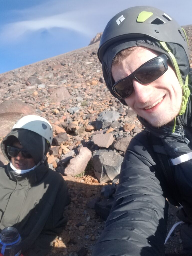
This is Michael S (2016-2020)! I recently climbed Mt Shasta in California, and thought there were some fun moments – this is my first ever trip report! This was done with a non-climbing club friend, hopefully that’s cool.
We threw on our helmets, checked how much water had melted overnight (just a little less than we would have liked), grabbed our packs, and headed out into the dark. After the initial ten-minute walk from our tent, we realized we might have to turn around for the most ridiculous reason. To get onto the route, we needed to go across a snow field that had totally frozen overnight. We had ice axes – we’d been warned that there was still some unmelted snow which ‘might present issues’; but the route was typically not at all technical, and we had really hoped that our lack of crampons wouldn’t be a problem. We’d hoped wrong. In any case, I stabbed the pick into the slope, and it seemed to be willing to hold my weight. I felt around on the ice for somewhere to place my feet, situating them on some lumpy looking thing while clinging desperately to the handle. I stabilized myself, pulled out the pick, stabbed it in again, and repeated the whole process. Chinmay (my old high school buddy and climbing partner) followed suit – this was his second time using an ice axe, where the first had been the previous day on a practice hill we’d tracked down. Slipping was fine, but doing so without an ice axe would probably break our legs; the slide was long and the snow was completely solid.
A solid twenty minutes later, we’d crossed the 40 foot wide snow field – a promising pace. Working our way up the trail, we realized that to actually get to the next segment of the climb, we would need to traverse the snow field a second time. We were experienced at this point, but that didn’t help us very much, as this traverse involved some upwards motion this time around. Another 20 minutes later, we had finally made it to the top of this first hill, and looked out over some cliffs. The wind was starting to pick up.
The next few hours were a 30 degree scree-filled fun-fest. The wind kept getting stronger, and we saw the clouds above us racing by at speeds I don’t think I’ve seen clouds move before. The pathfinding wasn’t too bad, but the walking was very unpleasant – the ground was almost gravelly, and it felt like we weren’t moving anywhere near as quickly as we would have been on a normal trail. Eventually, we hit this bright orange, mushroom shaped rock. Above us loomed some unassailable-looking cliffs, and to our right headed some convincing trail. But the further along this trail we got, the less trail there seemed to actually be. The stupid gravel now had these ball-sized rocks in it, and each step caused a metric crap-ton of loose rock and gravel to collapse. The larger rocks didn’t help either, because each time you stepped into this abominable ground it felt like an unlucky one could hit you in the ankle and roll it at best, break it at worst. We grew increasingly exhausted – this shit was the worst terrain I’d ever been on, and if this was to be our next several miles, we were definitely not going to finish.
After some deliberation, we decided that the trail had been a lie (at that point, it had all but disappeared), and started working our way up while also heading (horizontally) the other way. The reasoning that up was definitely at least a little bit in the right direction, and we had clearly been knocked off course. Eventually, we hit the base of those foreboding cliffs – only to discover that there seemed to be a passage. Another thirty minutes later, we saw some people crossing atop the cliffs. Clearly, we were finally back on route!
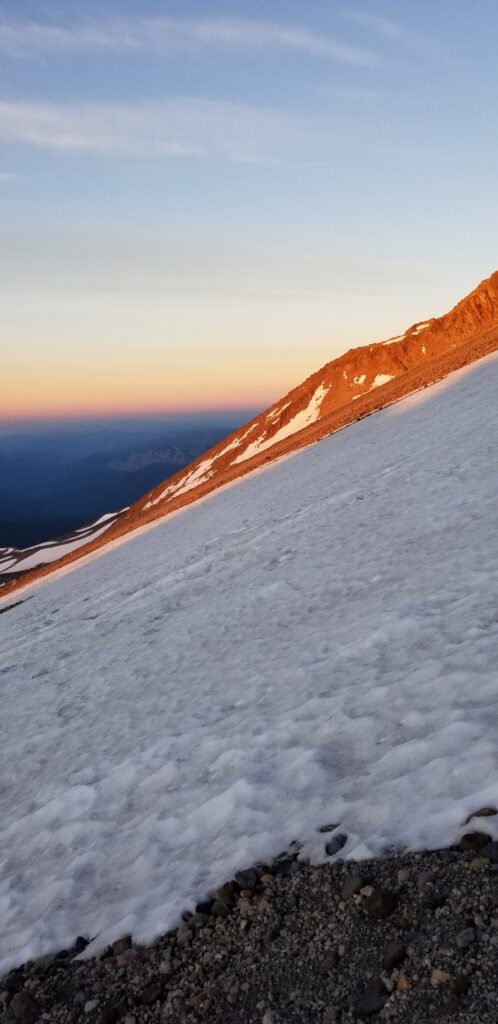
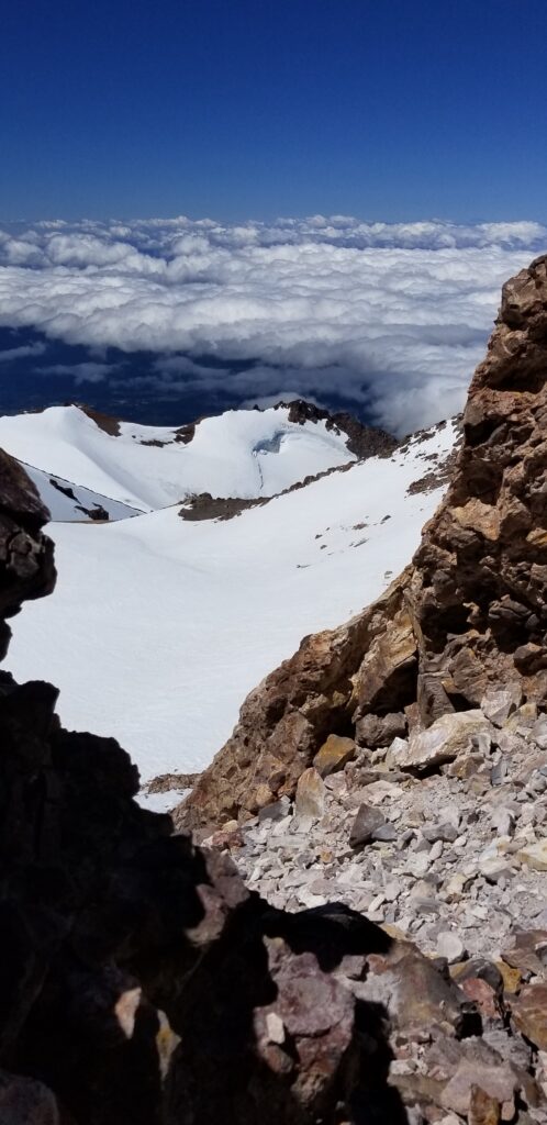
Unfortunately, just about at the same time, we had walked into some terrifying fog – not only did our visibility rapidly shrink to not more than 20 feet, but it was also painfully cold. As we approached the top of the couloir, the trail switched from easy scrambling to a comfy walk; the fog had not gone away, but the wind had gotten even worse. Presumably, this is what had been chasing the clouds above our heads not but four hours ago. We kept walking till finally, we arrived at what looked like the summit plateau.
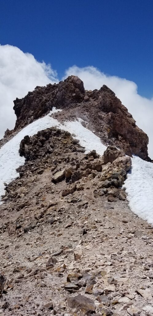
It was breezy up there to say the least. We had an hour left till our turn-around time, but it looked like we saw the summit. We spent fifteen minutes chugging up some scree hill towards the summit – only to realize the peak was almost exactly above us, a sheer cliff of forty feet directly above our heads. At this point, my climbing partner seemed to be getting hit by hypoxia – he wasn’t entirely coherent, and moved sluggishly. The cold and wind relentlessly whipped at our faces…. We really hadn’t planned to spend this long on the plateau, and summiting would take another thirty minutes. I was concerned – and my friend was just a bit too far gone to realize how concerned he should be.
We climbed back down to the plateau, and realized where we’d gone wrong. It would be massively painful to have to turn back not more than fifteen minutes away – and we still had the time. I was increasingly concerned about my friend, and tried to convince him that this probably wasn’t a good idea, that he had to save some fuel for the long way down. But he insisted, and so finally, we summited.
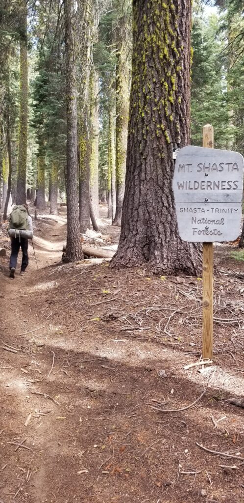
Mt Shasta has always loomed tall in my life – when I was a kid growing up, some of our outdoorsier friends had submitted it, but it remained remarkably out of reach for me. In 7th grade, my dad and I decided to learn some basic mountain climbing skills (basic crampons and ice axe; nothing crazy – no glacier travel or anything), and see if we could make it to Lake Helen, the location where most people spend their first night. But circumstances had always gotten in the way for a proper summit attempt – we didn’t have backpacking gear until the middle of high school, and by the time I would even consider it, I hit college. I joined the climbing club, but I was overloading on schoolwork, and so didn’t participate actively till my junior year or so (biggest mistake 😛 ). But around that same time, I realized that I was finally experienced enough to make a go at this mountain, and hit up some old high school buddies to schedule something for June 2020….
Then came corona – we thought the plan might be untenable, but thankfully restrictions were lifted, and we had a chance to make a go at it after all. We showed up to the rental shop on the last possible day to grab our picks – they were fresh out of crampons, but there was an alternate route (Clear Creek) that we knew we could take and avoid almost all snow/ice climbing. We spent the night in our car at 7k ft (bunny flat), and that next morning drove to the trailhead. The first hour or two was mega warm; we hit our first patch of snow after two hours, where I showed Chinmay how to walk with a pick and how to self-arrest while glissading. We’d worked our way up to about 9.5k feet to camp, and discussed whether or not we should try and cross the nearby snowfield today or tomorrow – we, fatefully, decided to do the next day.
I wish I could say summitting was some transcendental experience… but at that point, I was fucked up, cold, and very, very concerned for my climbing partner. We took a brief intermission, did the mandatory photos and logbook signature. But as we started our way down, something was obviously wrong. He was creaking at some incredibly slow rate, and as we hit the sections with loose rock, it became a snail’s pace. Eventually, we hit that orange mushroom rock of ill-repute. I sat there, in the fog and wind, waiting for what seemed like half an hour. I could see him the entire time, so I knew he was intact, just moving very, very slowly. As he strolled up to my hiding spot, he tripped – and after the trip, he started moving even slower. As he got within earshot (the wind was *loud*), he informed me that that last trip had probably sprained his knee, and that he would be going at the same pace the entire way down. We didn’t have food for that long of a descent, it just wasn’t practical to drag it up – so we were going to get to the car very late, and very, very hungry.
As we trudged down, he slowly became a tad more coherent (but no faster), and suggested that perhaps the snowfield we had had so much trouble with earlier had melted, and was a feasible glissade. I all but ran towards the thing, and indeed! Not only was it a glissade, but it extended all the way up from where we had crossed (nearly two miles down-trail!) to our current location. I ran back with the good news, and he eventually got to it – and from there, it was almost entirely smooth sailing. We arrived at our tent almost at a reasonable time, ate what little food we had left, packed our stuff (almost all our weight went on my back, for obvious reasons), took a thirty minute break, and headed down. The fog had gone away, and the wind was dying down – as we hit the creek after which the trail is named, it became clear that we were going to be just fine.
Ok that’s all I’ve got! Hopefully it’s alright and not too awful to read 🙂
Thanks,
Michael