By: Finnley Ryan
Date: December 20, 2023
Route: Presidential Traverse, White Mountains, NH
Team: Andrew Shusterman, Finnley Ryan, Matthew Krauss, Raphael Ottomani
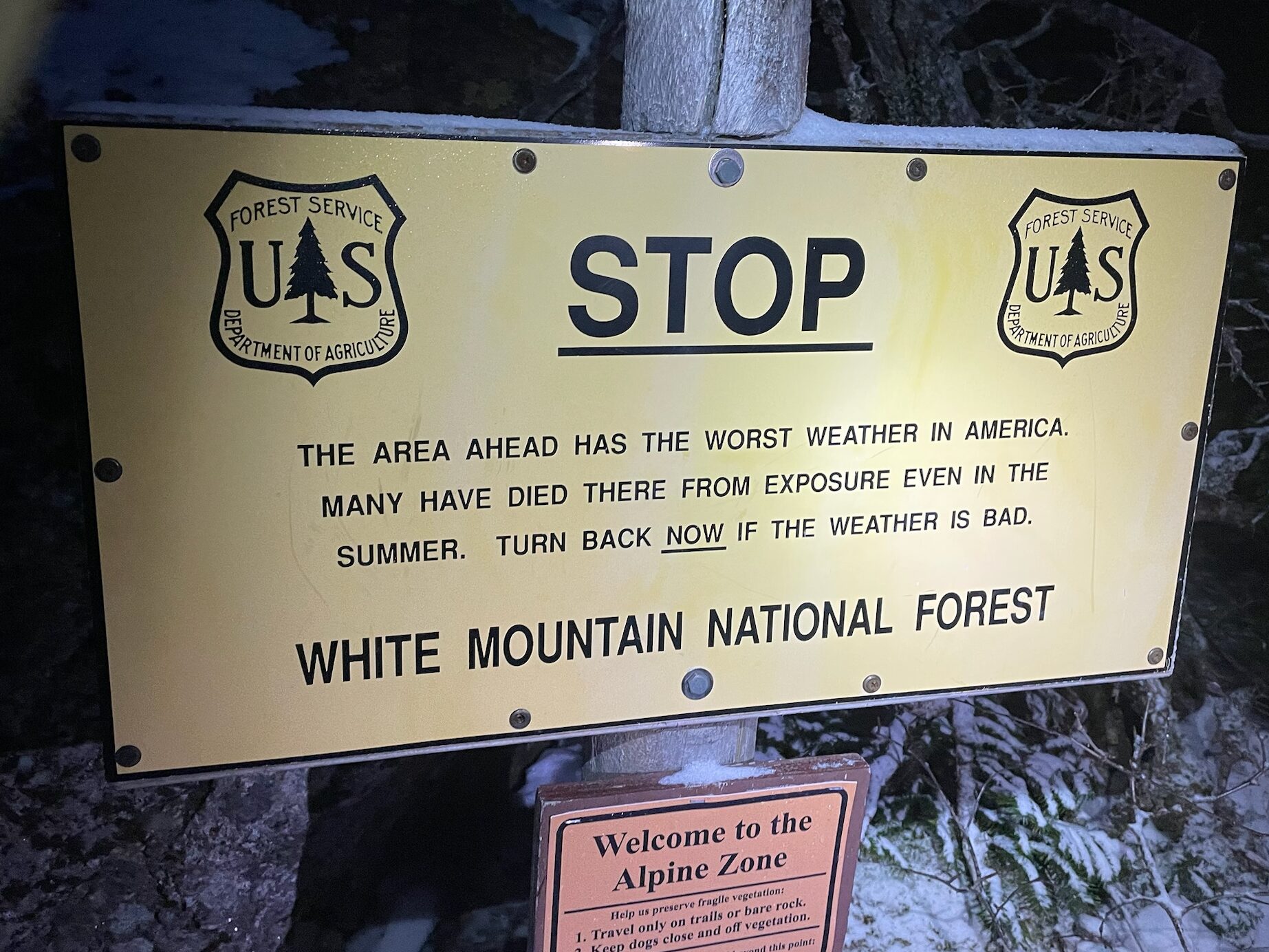
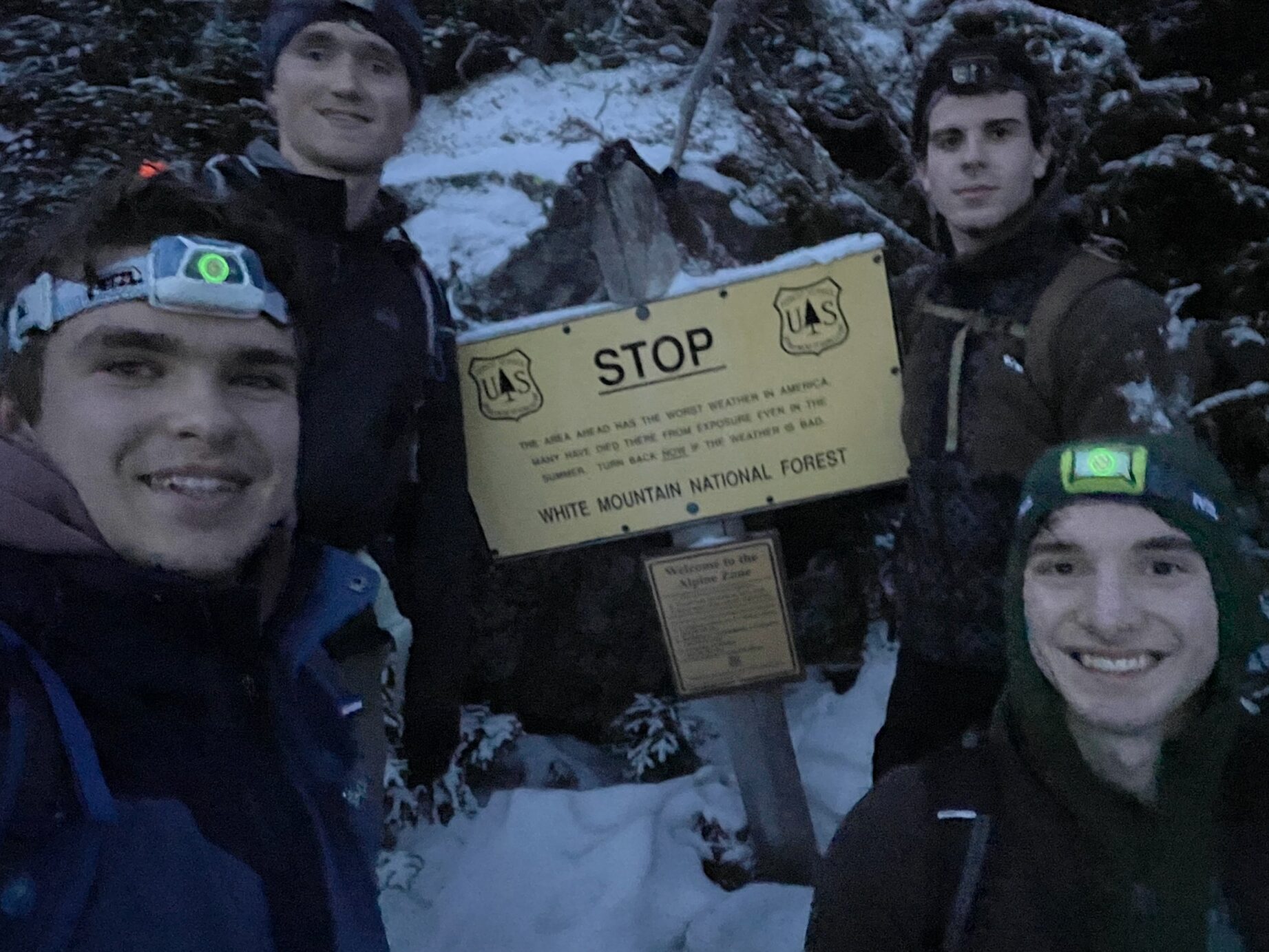
19 miles, 8500 ft of elevation gain, 7 iconic northeastern peaks. The Presidential Traverse in the White Mountains of New Hampshire is a marquee hike known for its difficulty and bad weather. As an ominous sign reminded us near the beginning of the hike, “This area ahead has the worst weather in America. Many have died from exposure even in the summer. Turn back now if the weather is bad.” Of course, we decided to attempt the traverse in the winter, a season when the Presidential Range sees 100+ mph winds 1 out of every 4 days.
When Andrew, who has done the winter traverse twice before, first approached the rest of us about doing this hike, weather was the main concern. A good weather window was truly required to make this hike possible, as there is little protection from winds and storms once above the treeline, which 10+ miles of the hike is, as well as limited options to bail or be rescued. As the planned date approached, we researched the route and the gear necessary, all while keeping a careful eye on the notoriously fickle forecast, which continued to look promising. However, a couple of days before we planned to do the traverse, a large rainstorm hit the region, causing major flooding and closing several roads. Our plan was to do the traverse followed by a few days of skiing in southern Vermont, but as it stood, the map showed the road by the south terminus closed due to flooding, so the ability to do traverse was really up in the air, despite the promising weather forecast for the planned date. Thankfully, after calling around to some local places, we got confirmation that the road was open. Our Presidential Traverse attempt was a go. After stopping in Hanover for some fuel in the form of Thai food and prepping our gear at our hotel near the north terminus, we settled into bed for a few hours of sleep, full of excitement and a healthy dose of nervousness for the day ahead.
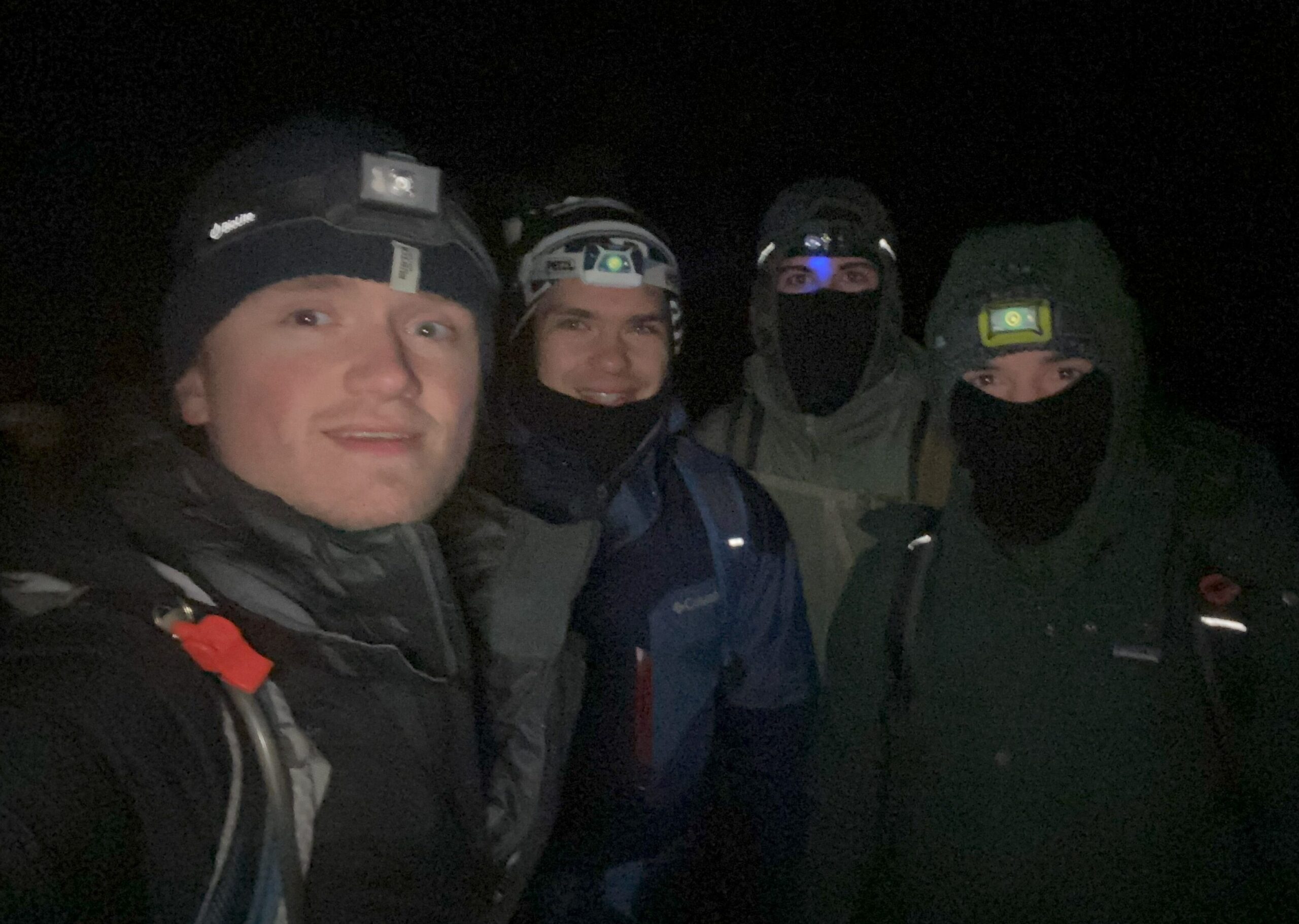
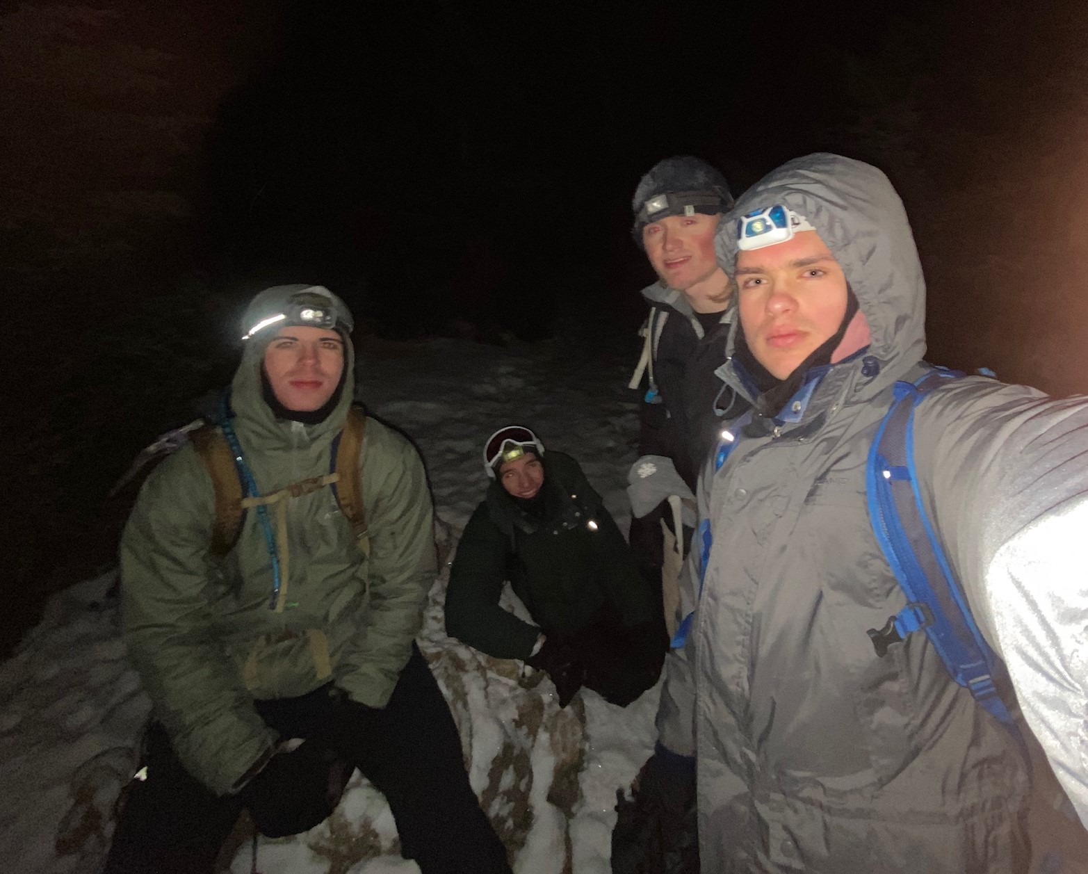
Then at 4 AM, two New Yorkers, one Connecticuter, and one Marylander – four East Coast representatives of the UIUC Climbing Club – set out in the darkness by the light of headlamps to begin what would be a very long day.
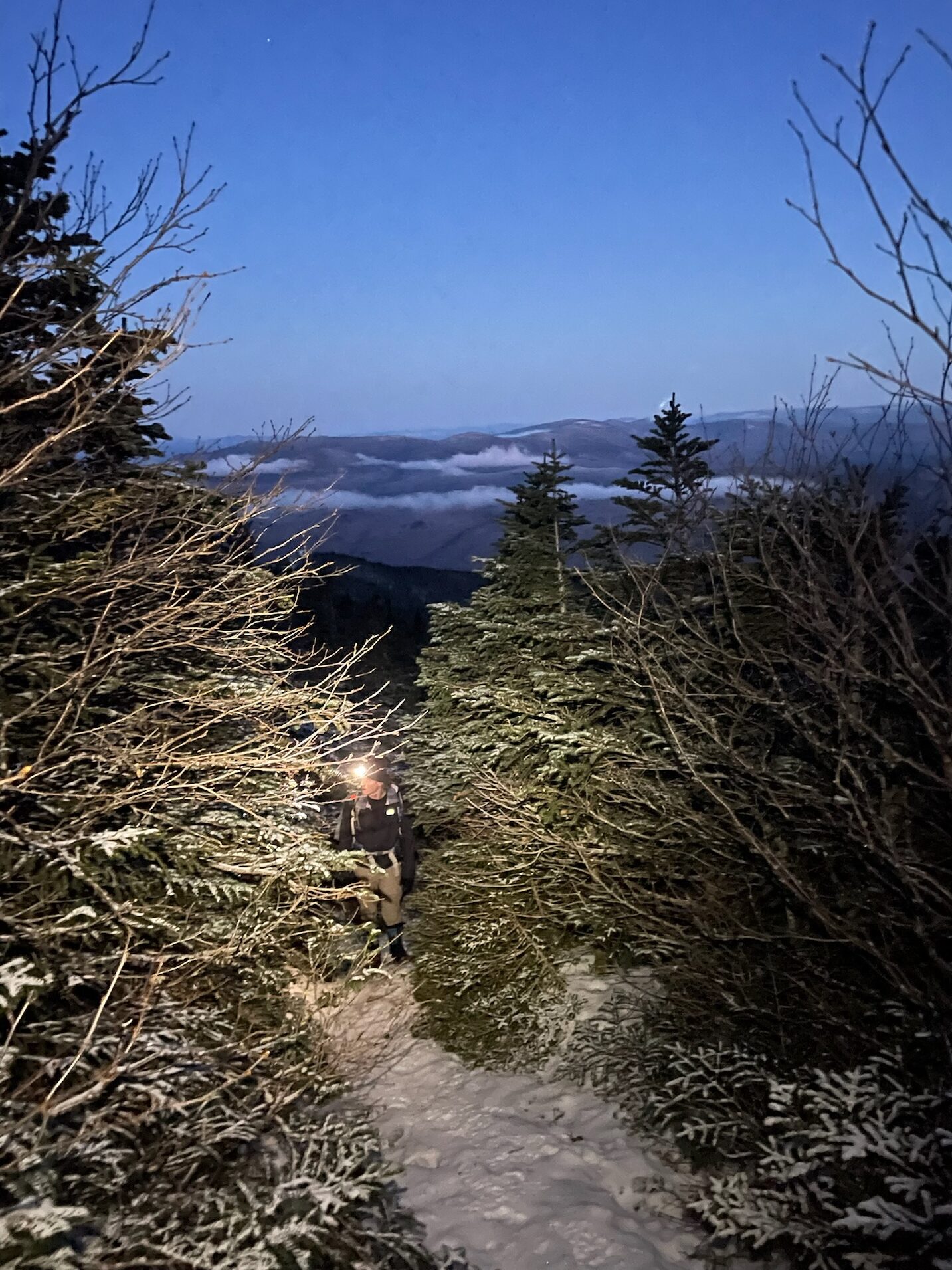
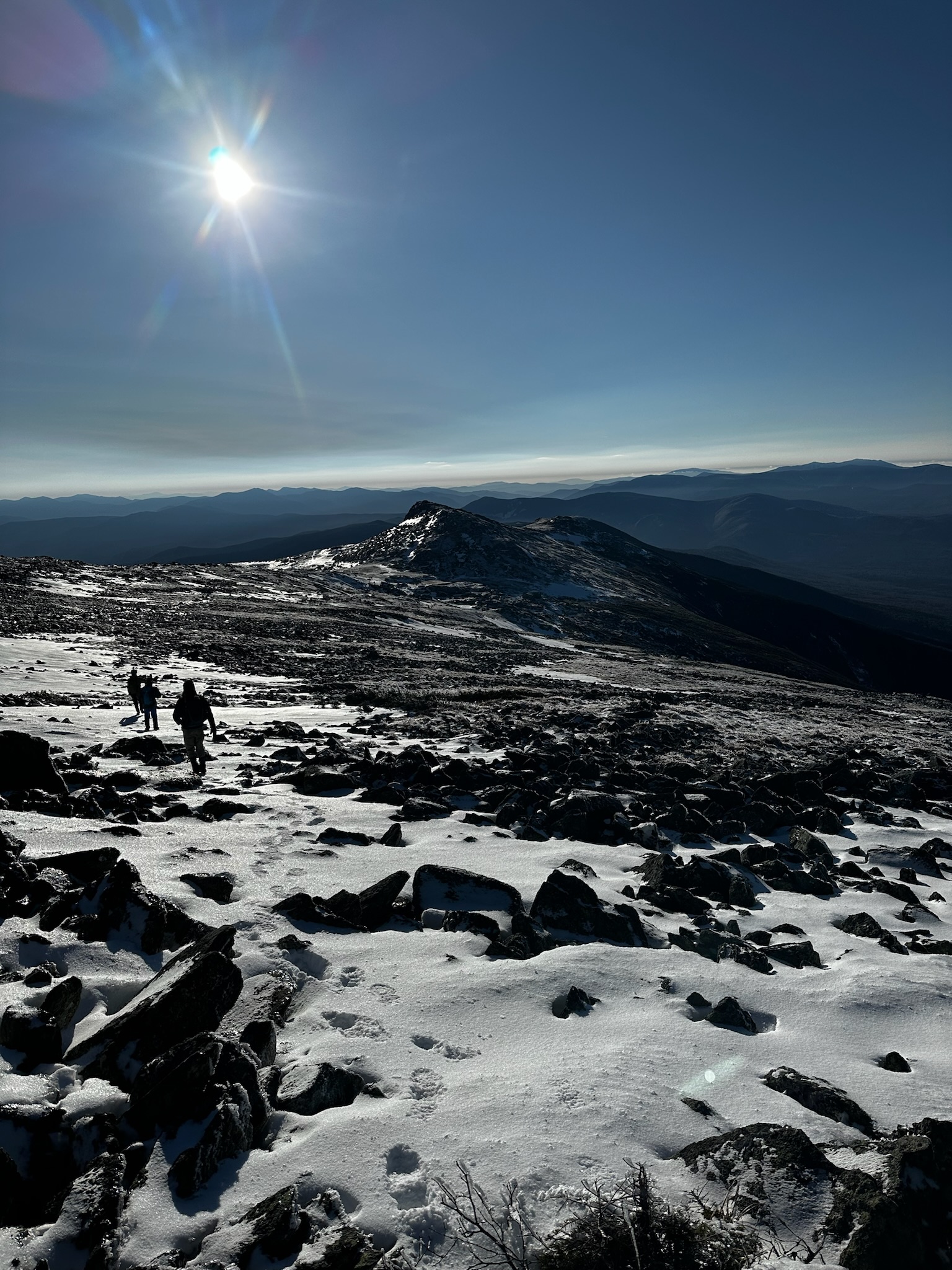
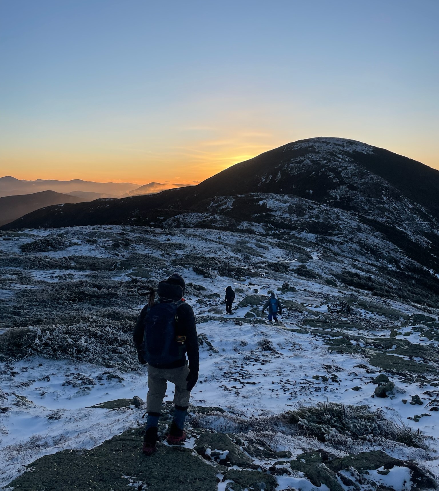
The traverse began with a long climb in the forest up to a closed backcountry hut which sat just above the treeline and below the first peak, Mt. Madison (5,367 ft). We quickly realized that our numerous layers in anticipation of the cold forecast were mostly unneeded as the quick elevation gain and lack of wind made us heat up quickly. Just like the song “Hot and Cold” by Katy Perry, this traverse would include lots of ditching and adding layers as we transitioned from uphill to downhill and terrain sheltered us or left us exposed to the wind. We leapfrogged with two local guys dayhiking Madison on the way up, making good pace with occasional stops for food, water, and to catch our breath. The landscape began to reveal itself as the predawn sky lightened, energizing us to climb on in anticipation of the sunrise and views ahead.
As soon as we got above the treeline, where we were warned by the ominous sign, it was considerably colder and we quickly stopped to add back all the layers we had stripped earlier.
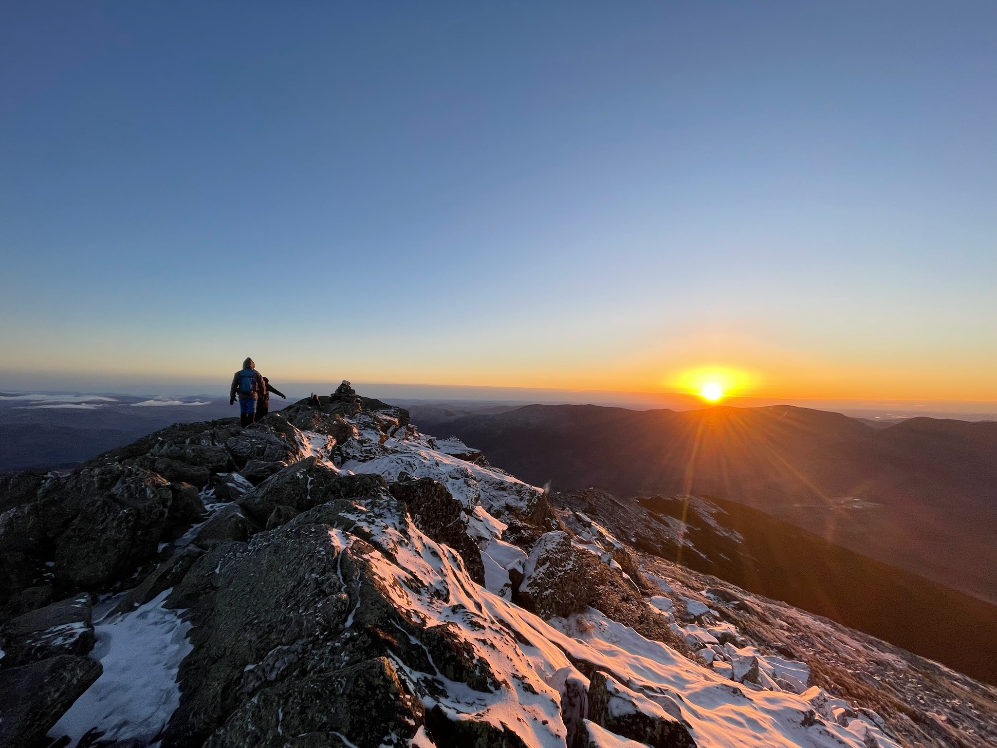
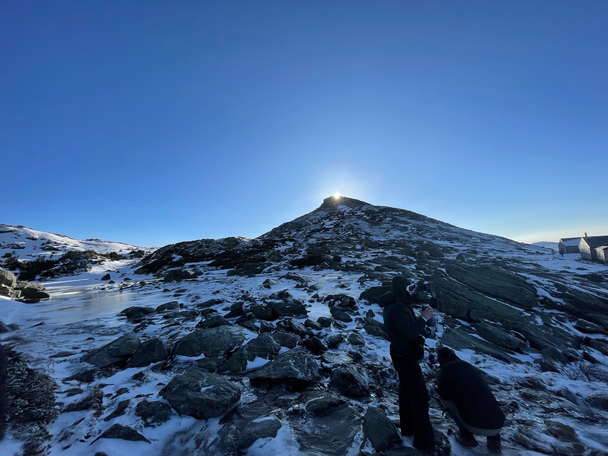
With a relatively short push from cairn to cairn up the jumbled rock surrounding the peak, we reached our first summit right as the sun crested the horizon, setting us and the surrounding mountains awash in golden orange. Laid out before us in all the splendor of a clear dawn was Mt. Washington (6,288 ft) and the ridge we would follow to get there (just the first half of the journey).
At the summit of Madison was where we got our first taste of the intense winds the range is known for and which would be a persistent part of our journey, so after a quick picture we hustled back down to the shelter of some shrubs and had a quick “meal” of Clif bars and peanut butter sandwiches.
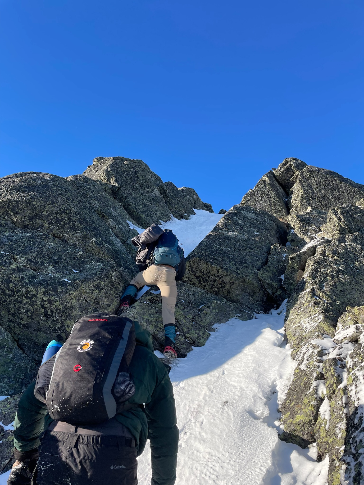
The next peak up was Mt. Adams (5,774 ft), which gave us some wind protection as we climbed up the lee side, but we lost the trail a bit and ended up going more or less straight up which became something of a scramble in sections.
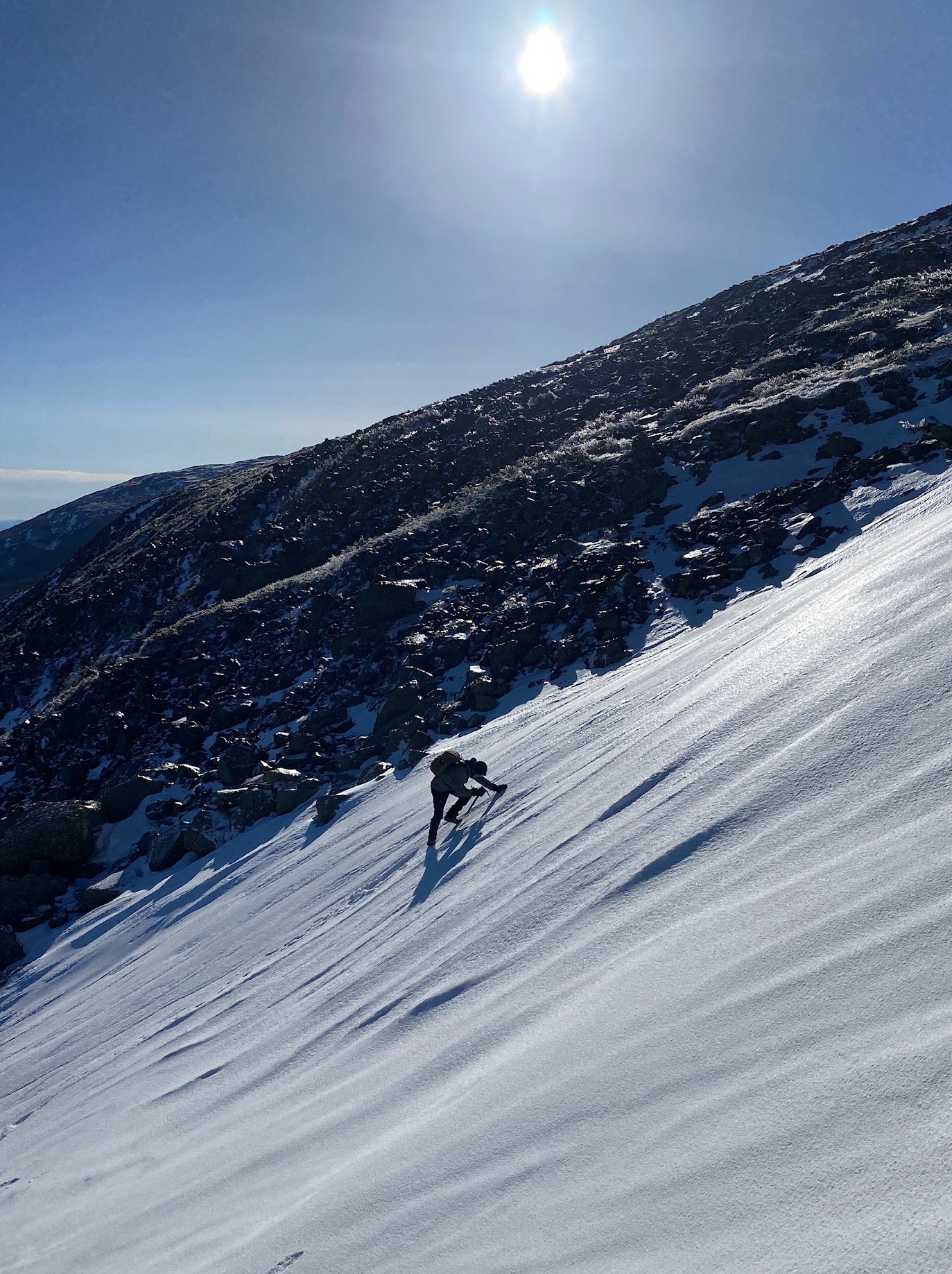
Right before the summit I got to pull out the ice axe for the first time and climb up a small snowpack which was a fun thing I had never tried before!
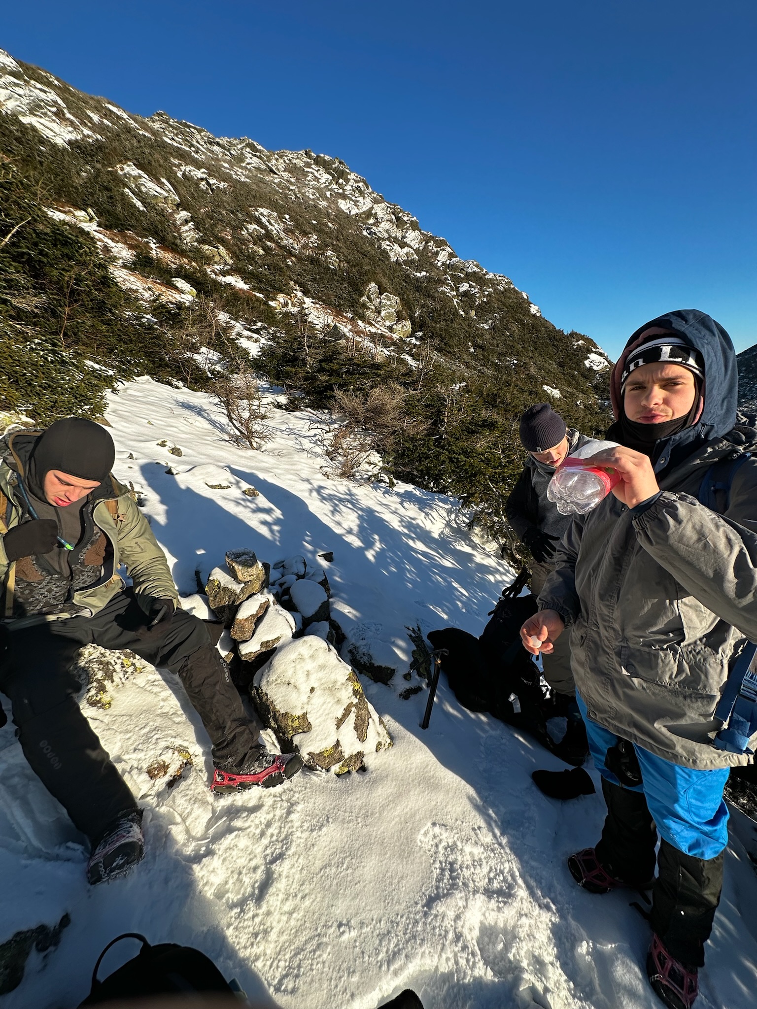
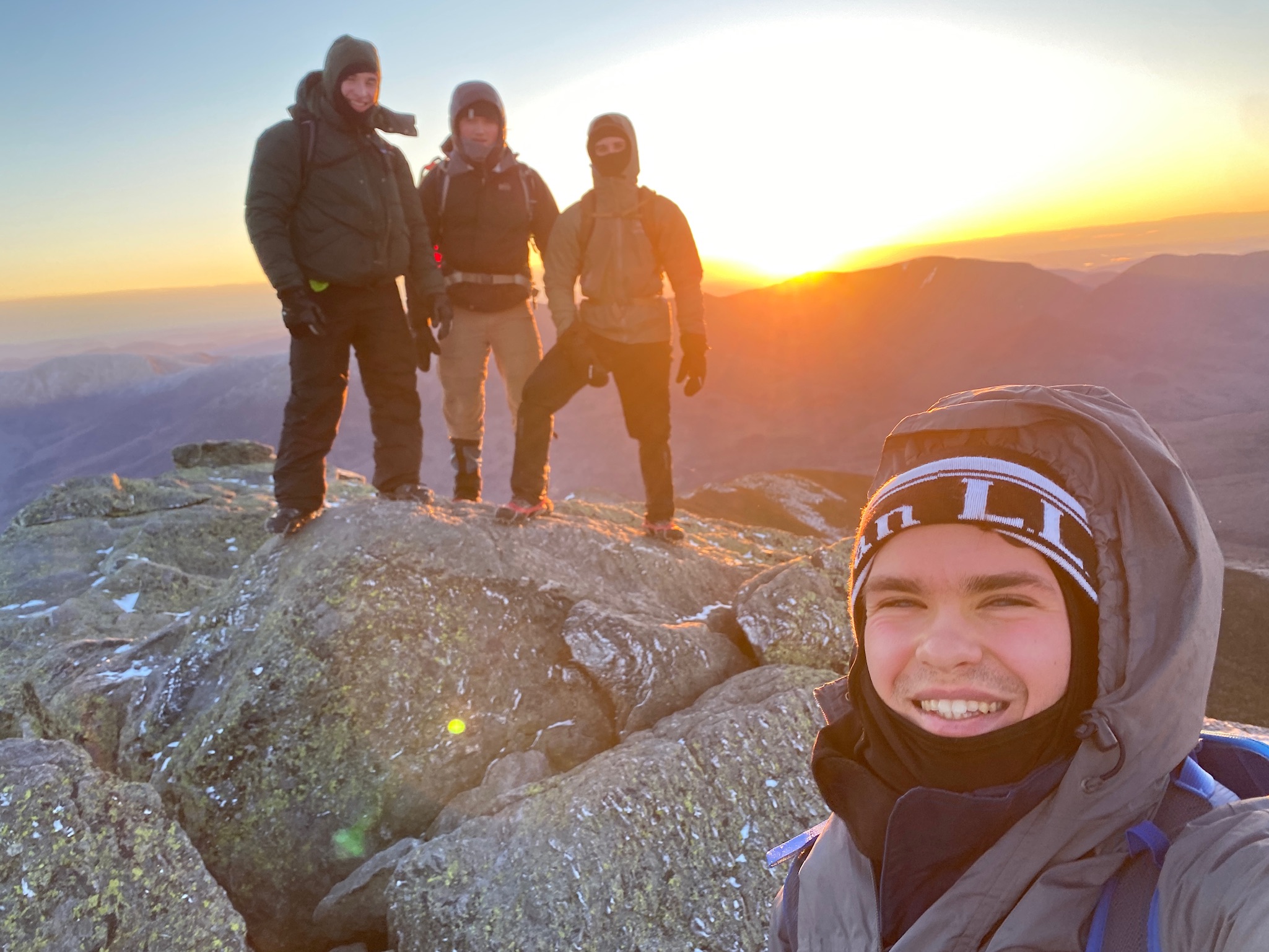
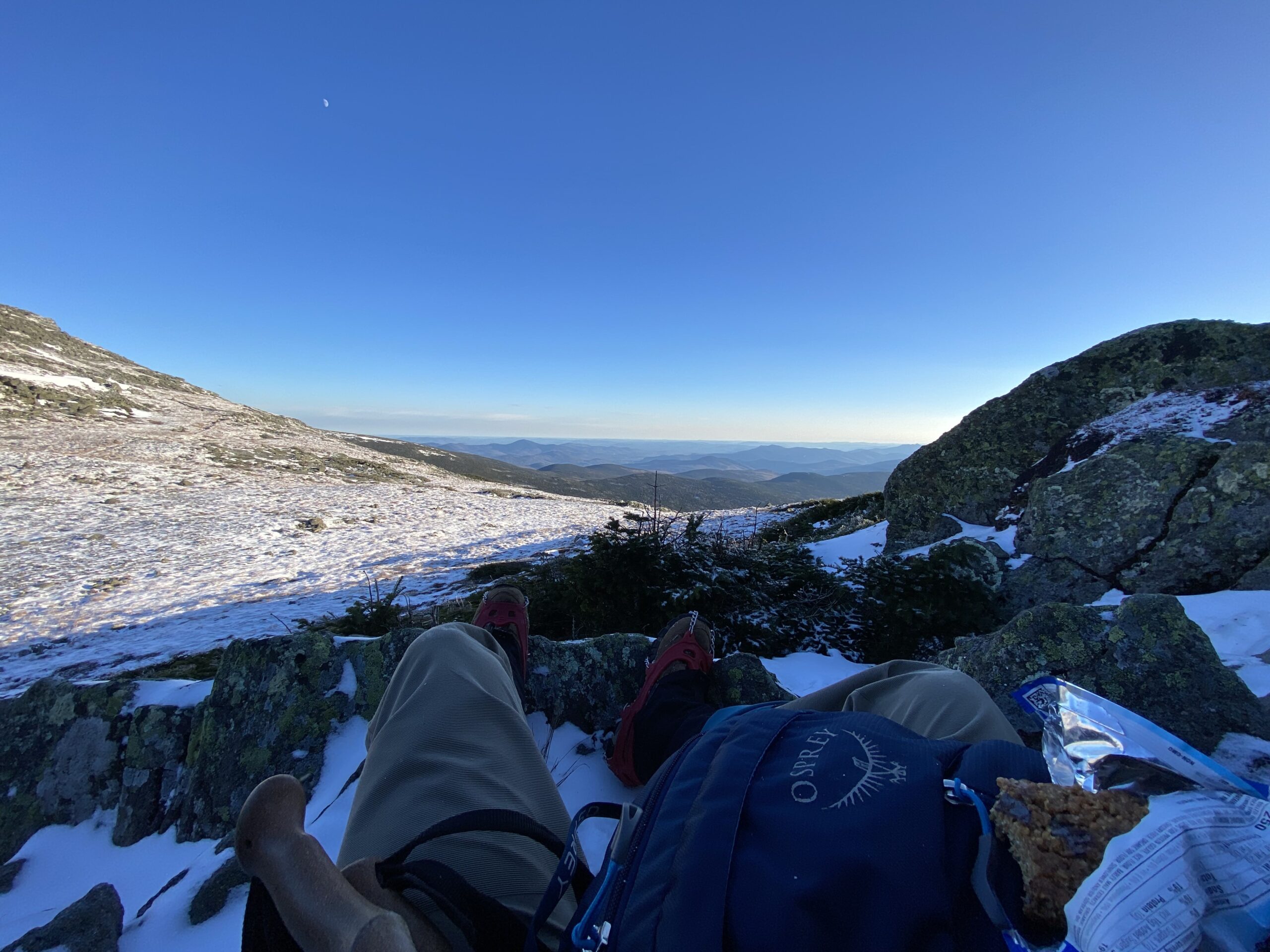
Reaching the summit of Adams, we were once again exposed to the fierce winds, so we touched the top and took our pictures, then sheltered behind some rocks to have our summit prize: a square of Trader Joe’s 85% Cacao Dark Chocolate. The cold, hard chocolate served as motivational fuel to incrementally mark our progress at each peak, two of which had now been achieved. Looking out along the range that laid ahead, however, there was still so much to be traveled, even just for the first half to Mt. Washington.
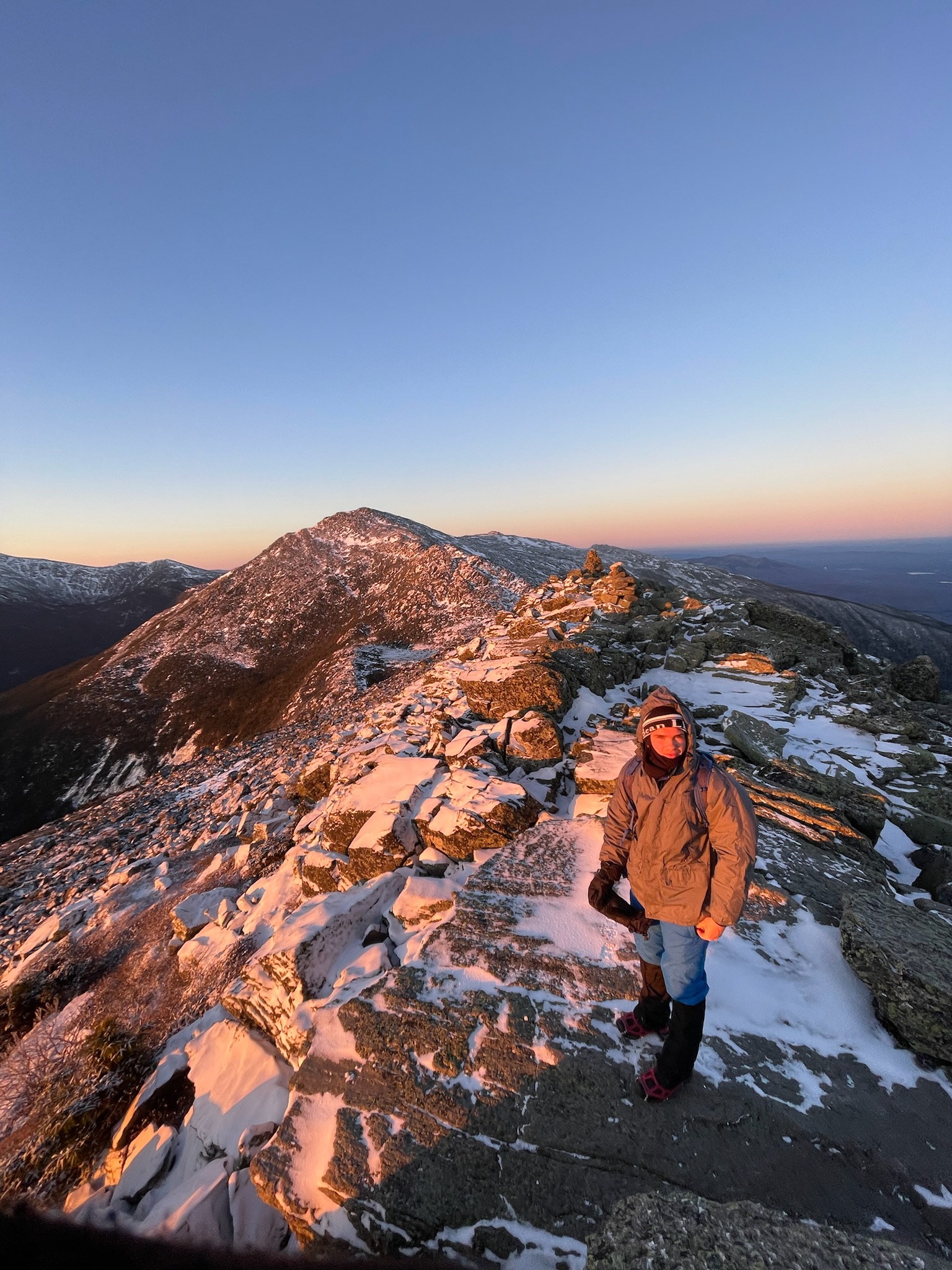
This thought kept nagging at me as we continued on towards Mt. Jefferson (5,712 ft), especially how it was already about 10 AM and many miles and feet of elevation gain remained. The excitement and energy of the hike’s beginning was starting to wear and we had to settle into the long haul. Maintaining a good mental headspace was key, and it was moments like that one where I had to focus on taking each section or peak one at a time and settling into a rhythm of steps, especially on the climbs. We spread out a little on the climbs according to pace, and there wasn’t much talking as we focused on the physical task, which I think made it tougher mentally as you were left with your own thoughts.
Ever invigorating, however, were the views, which stretched for miles. The beauty of the landscape combined with the difficulty of moving through it was a powerful testimony to the grace and might of nature. Just the same as we could look forward along the Presidential Range and see many miles of unknown terrain remaining, we could also look back and see the landscape we traveled upon so intimately become part of the vast range once more as we moved further and further away. This was a nice reminder of the forward progress we had made, but climbing up Jefferson still felt especially hard, as physical and mental fatigue compounded. Upon reaching the summit of Jefferson, we were all tired and agreed we needed to eat more and keep our energy levels up higher, so we had our second “meal” of the day.
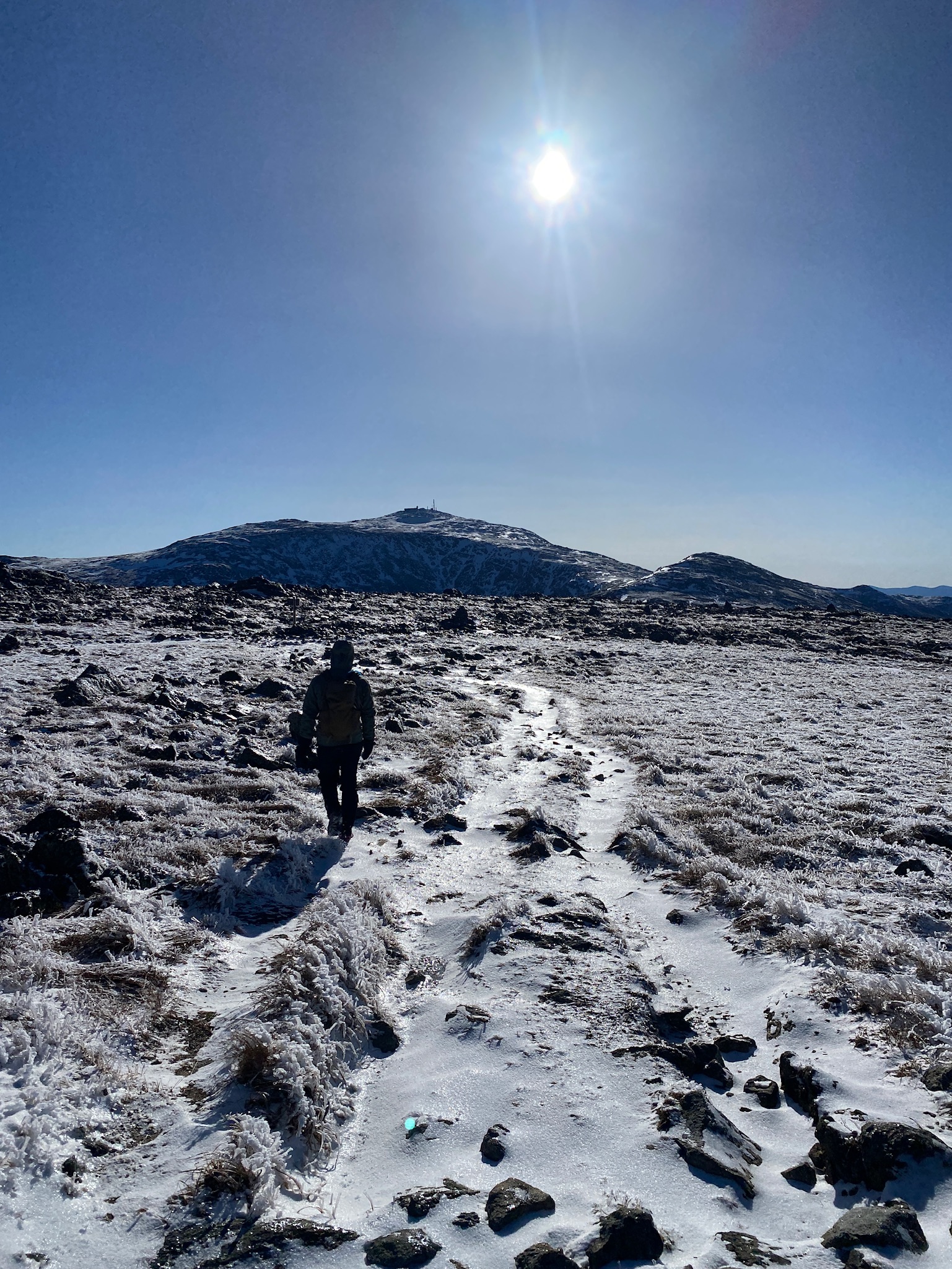
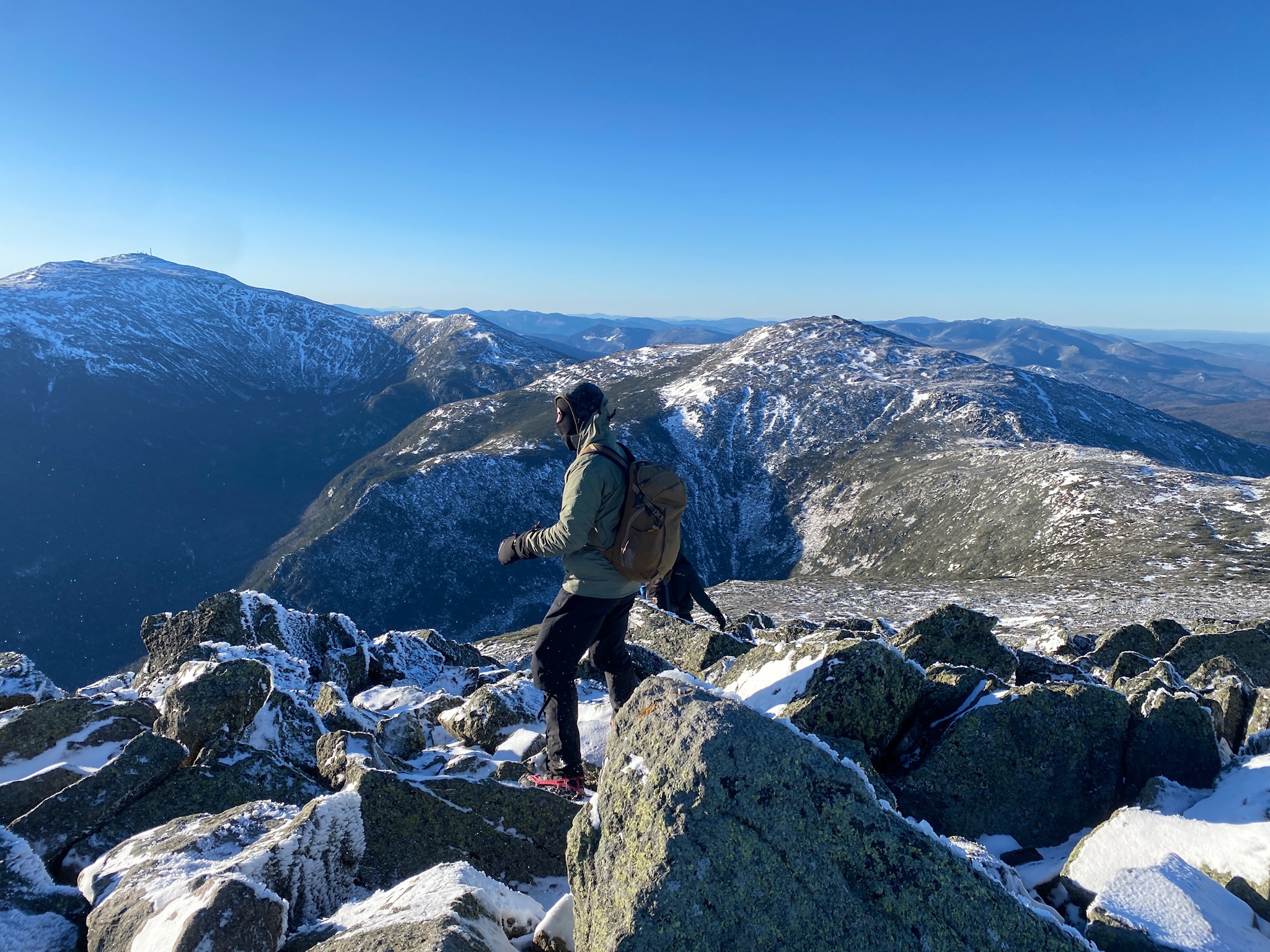
The food boosted our energy, as did the fact that Washington was the next main peak and we could now see past it to the mountains of the second half, which were supposed to be easier than the first half. Mt. Washington loomed large ahead of us, the tallest peak of the Northeast, but recharged we carried on.
The hike up Washington, which included the subpeak Mt. Clay (5,533 ft), was the most elevation gain since our initial hike up from the trailhead, but it didn’t feel as bad because we were so close to such a major point. The cog railway also helped. Constructed in 1869, the railway still takes visitors up Mt. Washington to the summit during warmer months, and for hikers of the traverse it serves as an elevated platform to walk along for about half a mile. Snow coverage on the hike was pretty consistent, about a few inches of pack, but a lot of what we were walking on was jumbled rocks and ice from the rain a few days prior. Microspikes were key for safe travel. This terrain was tough on the ankles and knees – especially on downhills – so the short section on the cog railway was a nice relief.
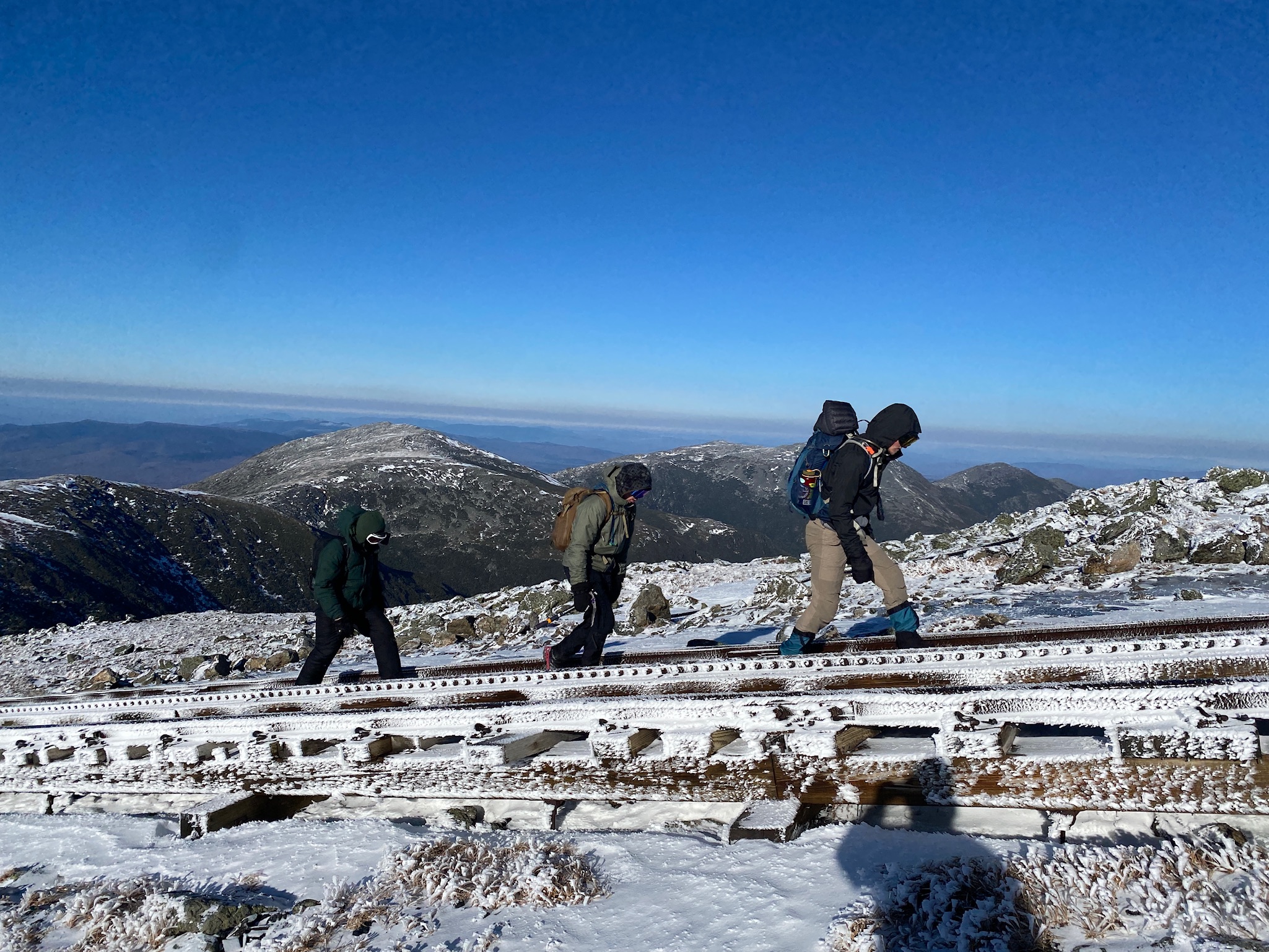

Winds increased as we approached the summit of Mt. Washington and when we finally reached the top it was the fastest of the entire trip. The max speed of the day reported by the observatory weather station was 81 mph, and when we were up there it was at least 45+ mph!
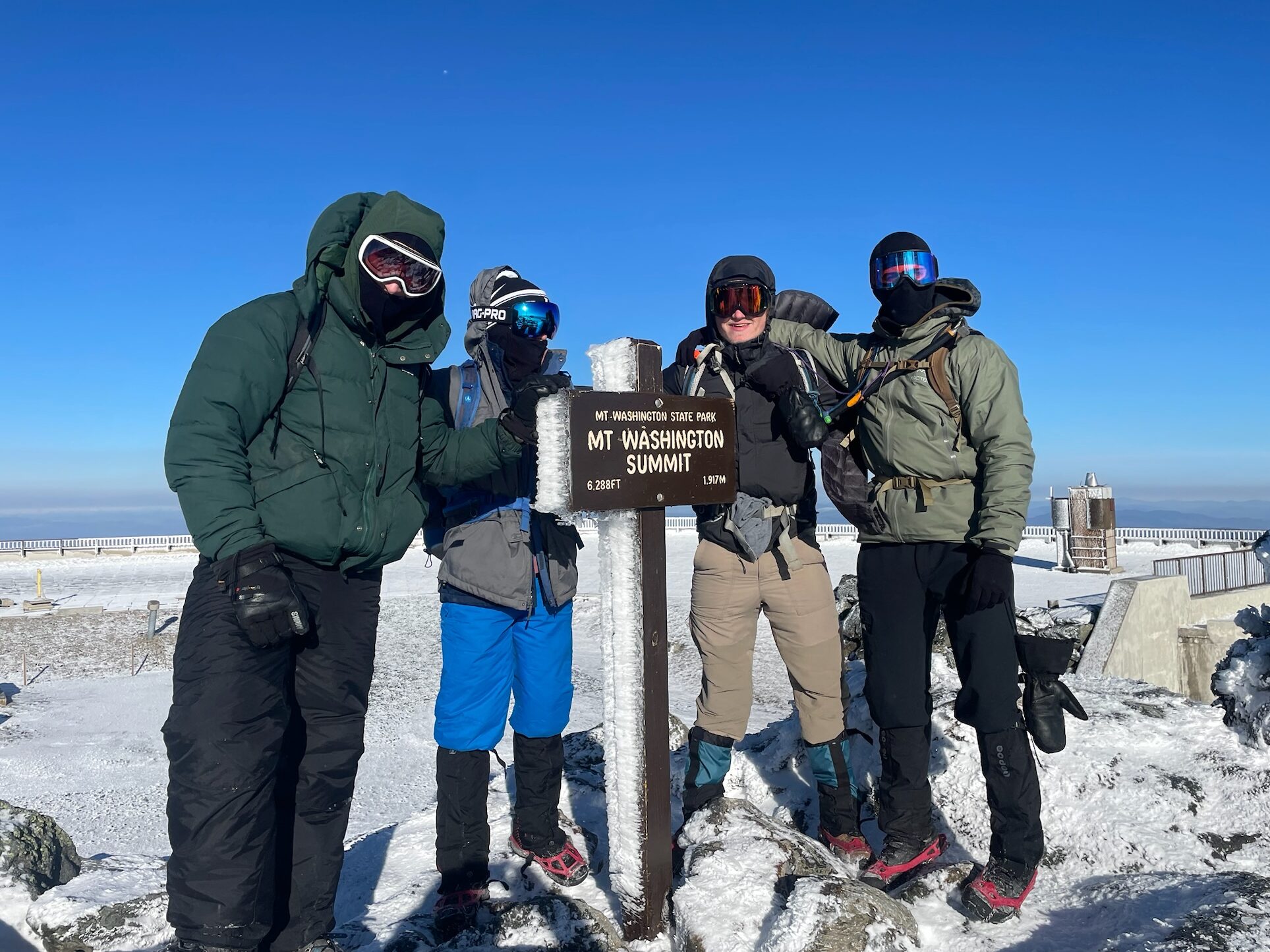
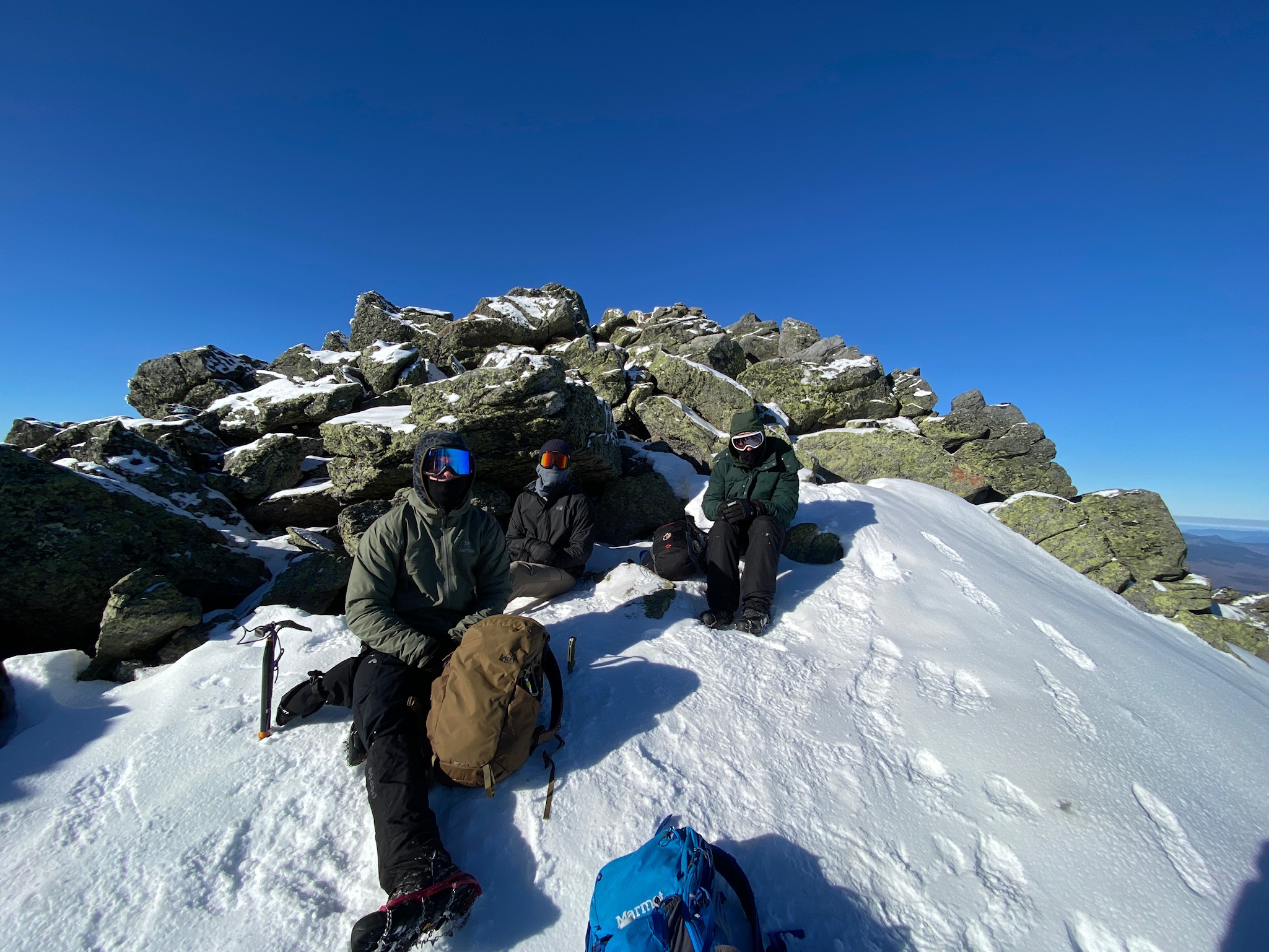
Elated with reaching the high point and halfway point of the trip but battered by the winds, we tried to take shelter behind some buildings at the summit for food and adding some layers, yet it was bitterly cold and we couldn’t stay there for long. The only other person we saw on the summit (besides a weatherman adjusting some instrument in the station tower) was a man who had just climbed solo up the Tuckerman Ravine, which he said was quite icy and windy. We wished each other well and hurried off the summit to get some reprieve from the wind. Now we had three main peaks left which laid out in a straight line ahead of us as we descended Mt. Washington and the peaks of the first half disappeared from view.
After a long stretch of descent, which was tough on the joints, we went up Mt. Monroe (5,372 ft) fairly quickly, leaving just Mt. Eisenhower (4,780 ft) and Mt. Pierce (4,310 ft) left.
After Monroe however, Matthew was finding it hard to catch his breath and was struggling to keep pace, which was worrying since we still had a decent distance left to cover, even if we went down a bail route. I, too, was having trouble keeping pace, as the descents were tough on my legs and my lungs were really working hard in the cold air on the ascents. At that point we had been moving in the mountains for about 10 hours and our bodies were tired. Being battered by the constant wind, which seemed to be faster and harsher than the morning, also didn’t help. Raph and Andrew were certainly tired, too, but they always looked strong and were able to keep up a good pace, which was impressive. Looking back, it would have been wise to have done some more physical preparation and eaten more the day before for this hike, but at that point we were fully in it, out in the alpine with just us four. We had to be safe and listen to our bodies, but also keep moving, as there were only 2 or 3 hours of sunlight left. After taking a break to assess how Matthew felt and refuel, we decided to slow down the pace, take more small breaks, and stop in the valley below Eisenhower, where we could decide to bail down a side trail if need be.
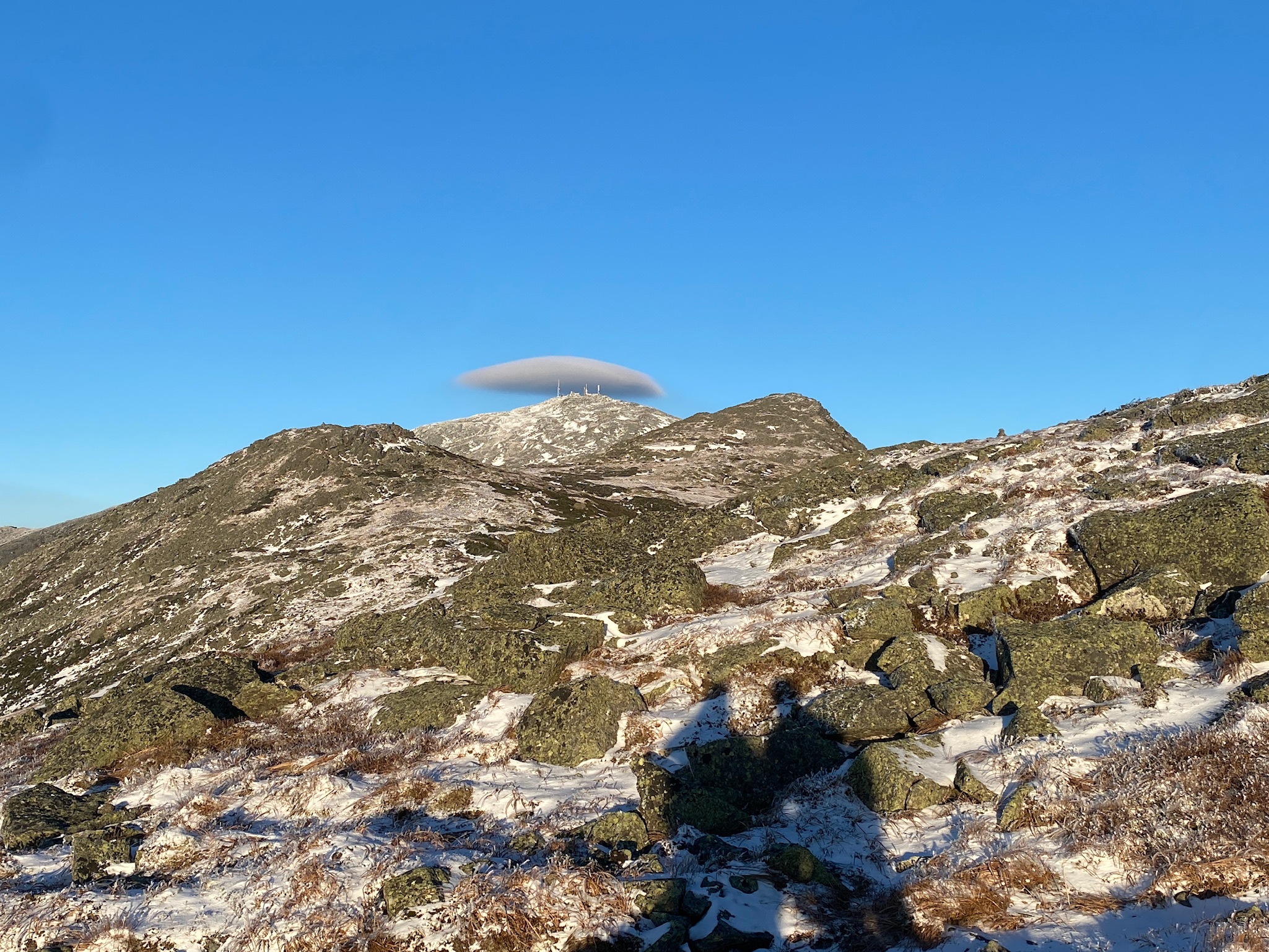
Around that time, we also saw a really cool lenticular cloud form over Mt. Washington that looked like a UFO!
The next two miles, which included the subpeak Mt. Franklin (5,003 ft), were mostly downhill and very windy, but we kept moving as the sun got lower in the sky and reached the valley around 4 PM.
This was a critical decision for us. Do we make a push for it up Eisenhower and keep our traverse attempt alive, or do we bail down this other trail which will get us below the treeline and back to the road? On the stretch down to the valley, my body was feeling very beat up and I was thinking the smart move would be to take the bail route and not risk getting caught above the treeline in the dark, especially since Matthew wasn’t really feeling well. Discussing as a group, we were torn. After Eisenhower, the treeline wasn’t much further, so we could get below the shelter of the treeline before dark and from there it was pretty much all downhill. Also, the bail route wasn’t quite a shortcut. It would take us out of the wind but still required several miles and put us on the road 4 miles away from where we left the second car. Matthew said he felt better and really wanted to just finish what we started, which we all obviously wanted to do, but we wanted to make sure we weren’t decided to go forth blindly just for the sake of completing the traverse. Indeed, we had already accomplished an impressive hike with most of the peaks. Ultimately, we decided to go for it. It was a calculated risk, sure, but it felt like the best option when we looked at it from the different angles. With no daylight to waste, we practically ran up Eisenhower – a relatively easy ~250 ft of elevation gain – as the sun was setting and clouds were rolling in, blowing fast over the summit.
For the last few peaks, we had postponed the chocolate in favor of expediency, so we just touched the top, took a picture, and hustled down the other side of the mountain for a few hundred yards until we reached the beginnings of the treeline, where some shrubbery gave us reprieve from the wind at last. There was a big sigh of relief from everyone at getting out of the wind and completing the sixth peak. Pierce was the seventh, but was the smallest and below the treeline. At the same time, while the hard part appeared to be over, there were still about 6 miles left, most of which would be done like we started, with a headlamp. Ironically, those last miles were some of the most arduous.
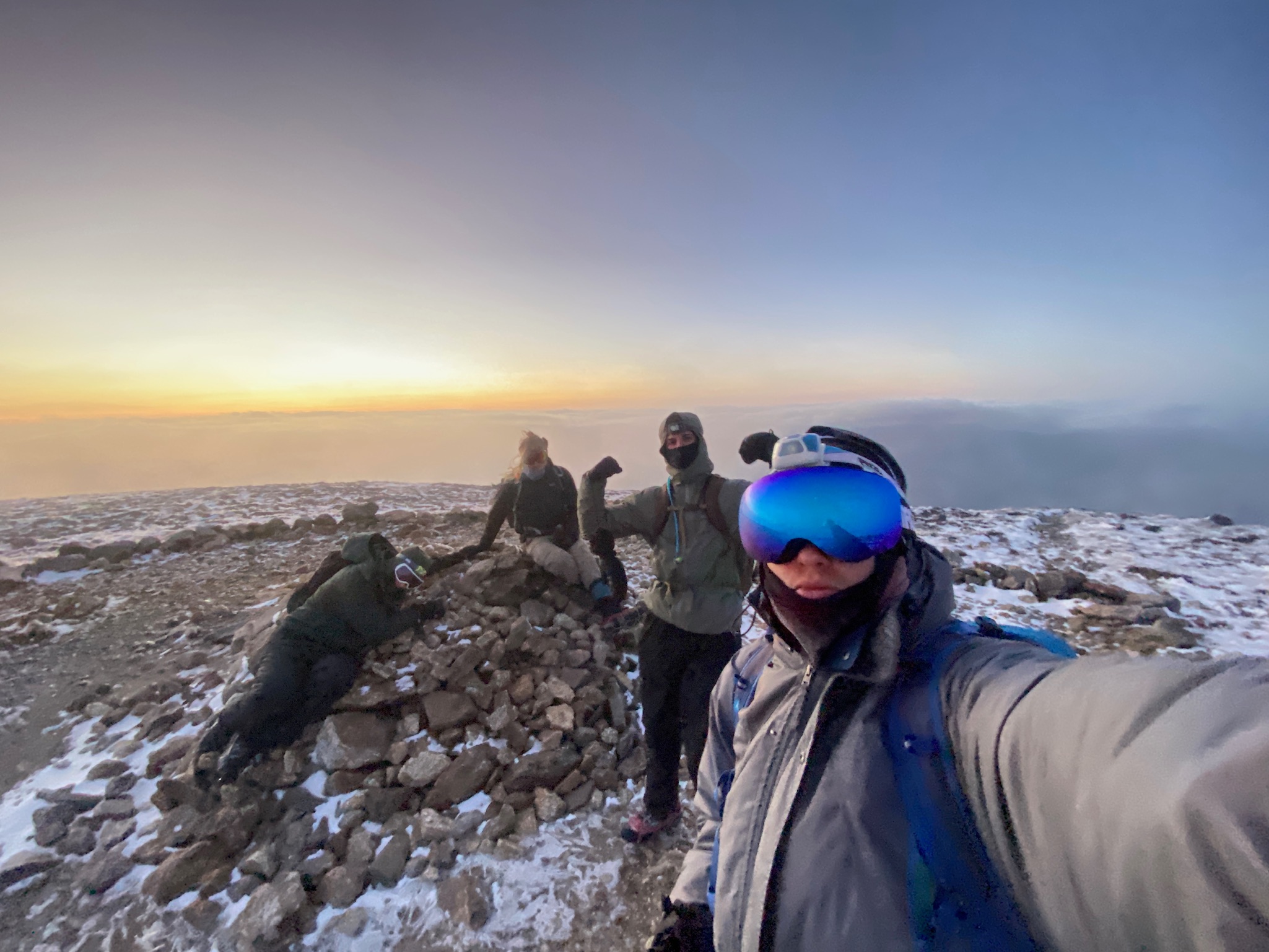
The hike to Pierce wasn’t tiring and not very steep so we were moving consistently and at a good speed, but it seemed to drag on forever, to the point where we were concerned that we may have made a wrong turn somewhere in the dark. AllTrails on Andrew’s phone told us that we were on the right path, and we eventually found Mt. Pierce, our seventh and final peak of the Presidential Traverse!
A big group hug of the cairn at the peak marked the finish of the summits… but not the finish of the traverse, because the adventure is never over until you’re back at the car – and we still had 4 miles of downhill to get there. We knew the 4 miles would last a while, but filled with energy from getting Pierce we basically ran down the snow banked path.
After about a mile it started to get tougher to move fast as the trail became rockier and steeper, and my joints had been pummeled all day. We didn’t take many breaks during this part and spread out, myself at the back, making my way down with increased difficulty. In the dark forest, with little comprehension of the world beyond the bounds of my headlamp, it was hard to gauge how close we were to the end. It didn’t help that the AllTrails distance never seemed to decrease as fast as you thought it should. This was the toughest mental stretch for me on the whole hike, as the jarring descent from rock to rock, trying not to trip or slip on ice, moving through the darkness seemed to continue forever. We would pass informational signs and think we were close only for the AllTrails to say we had even more remaining, which happened multiple times until finally we saw the glimmer of a road sign and finally reached the road, where we all promptly laid down like pancakes. Across the road was the parking lot, and when we finally reached the car after 14 hours and 51 minutes, the Presidential Traverse was complete.
The guy at the AMC Highland Center was kind enough to let us get coffee and tea, and it was so nice to sit our sore bodies down in a heated area after being out in the mountains for so long, thankful that we had experienced such an amazing place and made it back safely, knowing that we could finally rest after a day full of Type 2 fun. I can certainly say that this was the hardest physical (and probably mental) activity I’ve ever done, and that made the sense of accomplishment for this journey ever more rewarding. I’m grateful to have experienced and completed this adventure with such a great group of friends, and I know this will be a profound memory for all of us, long after the physical soreness has gone away.